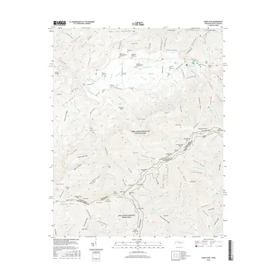
2016 Map of Cades Cove
USGS Topo · Published 2016About this map
Great Smoky Mountains National Park preserves a dense concentration of early Appalachian burial grounds and religious sites within the iconic valley of Cades Cove. This survey details the preservation of the landscape's social history through its numerous family and church cemeteries, including the Noah Burchfield Cem, Carver Feezell Cem, and the Ike Lequire Cem. The valley floor is circumscribed by the Cades Cove Loop Road, which connects the historic Cades Cove Primitive Baptist Church and Cades Cove Methodist Church with numerous trailheads. Beyond the settlement area, the terrain rises sharply toward the Tennessee North Carolina border. High elevation landmarks like Gregory Bald and Gregorys Little Bald overlook the valley, while the Appalachian National Scenic Trail traverses the ridgeline, following the boundary between Blount County and Swain County.
Find a feature on this map
174 named features on this map. Tap any name to fly to it.
Don’t see what you’re looking for? This feature index may not catch every label — zoom into the map to look around manually.
Map Details
Editions of this 2016 Cades Cove Map
This is the sole edition of this map. No revisions or reprints were ever made.
Other maps of this area

1886 · Knoxville
USGS Topo · 1:125,000

1892 · Knoxville
USGS Topo · 1:125,000

1894 · Knoxville
USGS Topo · 1:125,000

1895 · Knoxville
USGS Topo · 1:125,000

1901 · Knoxville
USGS Topo · 1:125,000

1933 · Bushnell
USGS Topo · 1:62,500

1935 · Fontana
USGS Topo · 1:24,000

1935 · Calderwood
USGS Topo · 1:24,000
1935 · Tapoco
USGS Topo · 1:24,000
1935 · Blockhouse
USGS Topo · 1:24,000