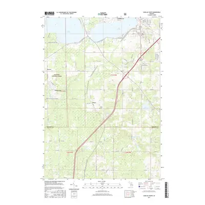
2017 Map of Cadillac South
USGS Topo · Published 2017About this map
The southern portion of Cadillac serves as the focal point for this landscape where Wexford and Osceola counties meet. The urban grid quickly gives way to a network of lakes and glacial terrain, including Lake Cadillac and the eastern edge of Lake Mitchell. This area reflects a long-standing recreation and transit economy, anchored by the Fred Meijer White Pine Trail State Park which follows the former rail corridor south through the county line.
Find a feature on this map
95 named features on this map. Tap any name to fly to it.
Don’t see what you’re looking for? This feature index may not catch every label — zoom into the map to look around manually.
Map Details
Editions of this 2017 Cadillac South Map
This is the sole edition of this map. No revisions or reprints were ever made.
Other maps of this area

1933 · Luther SE
USGS Topo · 1:31,680

1954 · Traverse City
USGS Topo · 1:250,000

1956 · Mesick
USGS Topo · 1:62,500

1956 · Cadillac North
USGS Topo · 1:62,500

1957 · Cadillac South
USGS Topo · 1:62,500

1957 · Luther
USGS Topo · 1:62,500

1958 · Traverse City
USGS Topo · 1:250,000
1983 · Dighton
USGS Topo · 1:25,000

1983 · Cadillac
USGS Topo · 1:100,000
1983 · Le Roy
USGS Topo · 1:25,000