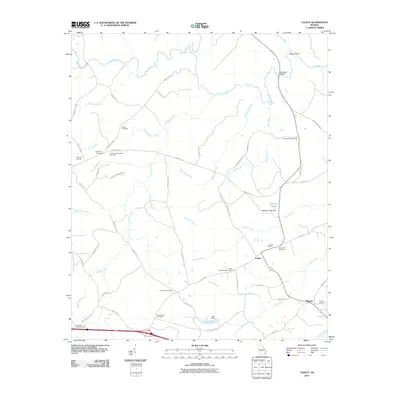
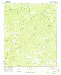
2011 Map of Cadley
USGS Topo · Published 2011About this map
The settlement of Cadley serves as a central point for this rural landscape in Warren County, where the topography is defined by the branching waterways of the Little River and Williams Creek. Numerous family and community burial grounds, such as Raytown Cemetery, Friendship Cemetery, and Winn Oliver Cemetery, are scattered across the terrain, suggesting a deeply rooted local genealogy. The network of rural roads, including Reynoldsville Rd SE and Upper Mill Rd NE, connects small agricultural hubs and landmarks like the Fountain Campground. Water management is evident through features like Mcbrayer Lake Dam and Ray Dam, which have shaped the local hydrology alongside natural features like Storks Bend and Soapstone Branch. This survey provides a clear view of the area's rural character, dominated by a mix of creek-bottom lands and upland farms just before the modern era of rapid digital mapping.
Find a feature on this map
64 named features on this map. Tap any name to fly to it.
Don’t see what you’re looking for? This feature index may not catch every label — zoom into the map to look around manually.
Map Details
Editions of this 2011 Cadley Map
This is the sole edition of this map. No revisions or reprints were ever made.
Other maps of this area

1906 · Crawfordville
USGS Topo · 1:125,000

1953 · Athens
USGS Topo · 1:250,000

1958 · Athens
USGS Topo · 1:250,000

1959 · Athens
USGS Topo · 1:250,000

1963 · Athens
USGS Topo · 1:250,000
1972 · Wrightsboro
USGS Topo · 1:24,000
1972 · Aonia
USGS Topo · 1:24,000
1972 · Thomson West
USGS Topo · 1:24,000

1972 · Sharon
USGS Topo · 1:24,000
1972 · Cadley
USGS Topo · 1:24,000