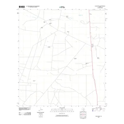
2010 Map of Cage Ranch
USGS Topo · Published 2010About this map
Cage Ranch and Wagenschein Ranch define this landscape in Brooks County, where the cattle-ranching legacy of South Texas meets modern energy extraction. The map illustrates a vast, semi-arid terrain organized around vital water sources, as seen in the frequent distribution of landmarks like Sancudo Windmill and Escondida Windmill. These structures are critical to the region's livestock operations, drawing water from the ground where seasonal flows like Calosa Creek and the waters of Cayetano Lake prove unreliable.
Find a feature on this map
16 named features on this map. Tap any name to fly to it.
Don’t see what you’re looking for? This feature index may not catch every label — zoom into the map to look around manually.
Map Details
Editions of this 2010 Cage Ranch Map
This is the sole edition of this map. No revisions or reprints were ever made.
Other maps of this area

1921 · Falfurrias
USGS Topo · 1:125,000

1939 · Encantada
USGS Topo · 1:62,500

1949 · Mc Allen
USGS Topo · 1:250,000

1954 · McAllen
USGS Topo · 1:250,000

1956 · Laredo
USGS Topo · 1:250,000

1957 · Mc Allen
USGS Topo · 1:250,000

1962 · McAllen
USGS Topo · 1:250,000

1963 · Flowella
USGS Topo · 1:24,000

1963 · Falfurrias SE
USGS Topo · 1:24,000

1963 · Cage Ranch
USGS Topo · 1:24,000