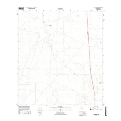
2016 Map of Cage Ranch
USGS Topo · Published 2016About this map
Cage Ranch and its private airfield, the Cage Ranch Airport, anchor this Brooks County landscape south of the South Texas brush country. The map documents a sprawling ranching infrastructure characterized by expansive grazing lands, including the notably named Los Muertos Pasture and Barroso Pasture. Water resources in this arid environment are concentrated along the ephemeral path of Calosa Cr and the seasonal basin of Cayetano Lake. The geography is defined by a sparse network of ranch roads and tracks that connect these working lands to the major north-south transit corridor of Route 281, reflecting the region's enduring reliance on large-scale cattle operations and private aviation in the early twenty-first century.
Find a feature on this map
7 named features on this map. Tap any name to fly to it.
Don’t see what you’re looking for? This feature index may not catch every label — zoom into the map to look around manually.
Map Details
Editions of this 2016 Cage Ranch Map
This is the sole edition of this map. No revisions or reprints were ever made.
Other maps of this area

1921 · Falfurrias
USGS Topo · 1:125,000

1939 · Encantada
USGS Topo · 1:62,500

1949 · Mc Allen
USGS Topo · 1:250,000

1954 · McAllen
USGS Topo · 1:250,000

1956 · Laredo
USGS Topo · 1:250,000

1957 · Mc Allen
USGS Topo · 1:250,000

1962 · McAllen
USGS Topo · 1:250,000

1963 · Flowella
USGS Topo · 1:24,000

1963 · Falfurrias SE
USGS Topo · 1:24,000

1963 · Cage Ranch
USGS Topo · 1:24,000