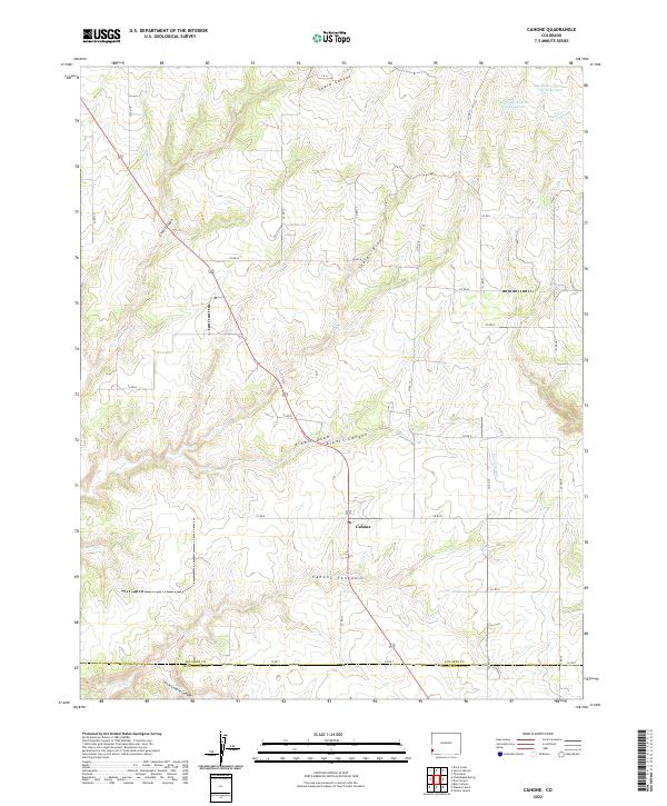
2022 Map of Cahone
USGS Topo · Published 2022About this map
Cahone serves as the central hub of this southwestern Colorado agricultural and canyon landscape, situated near the boundary between Dolores and Montezuma counties. The settlement is marked by a concentrated cluster of structures including a Po, while the surrounding plateau is defined by a grid of county roads such as Co RD 13 and Co RD P. The geography is characterized by deep erosional features like Cahone Canyon and Cross Canyon that cut through the high plains. Water management is a primary theme of the area's development, evidenced by the Dove Cr Canal and several storage sites to the north, including the Mel Dalton Number One Reservoir and Sagebrush Number One Reservoir. These irrigation systems support the high-altitude farming operations that dominate the flatlands between the canyon draws.
Find a feature on this map
32 named features on this map. Tap any name to fly to it.
Don’t see what you’re looking for? This feature index may not catch every label — zoom into the map to look around manually.
Map Details
Editions of this 2022 Cahone Map
This is the sole edition of this map. No revisions or reprints were ever made.
Other maps of this area

1956 · Cortez
USGS Topo · 1:250,000

1957 · Cedar 3 NW
USGS Topo · 1:24,000

1957 · Cedar 3 SW
USGS Topo · 1:24,000

1958 · Cortez
USGS Topo · 1:250,000

1959 · Cortez
USGS Topo · 1:250,000

1962 · Cortez
USGS Topo · 1:250,000
1964 · Secret Canyon
USGS Topo · 1:24,000

1964 · The Glade
USGS Topo · 1:24,000
1964 · Dove Creek
USGS Topo · 1:24,000

1965 · Cahone
USGS Topo · 1:24,000