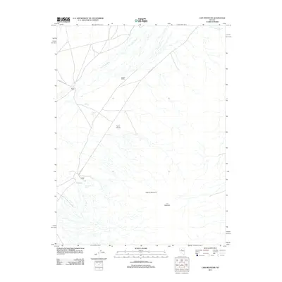
2011 Map of Cain Mountain
USGS Topo · Published 2011About this map
Jersey Valley and the northern slopes of the Augusta Mountains characterize this high-desert basin in central Nevada. The geography is defined by a series of critical water sources, including McCoy Springs and J S Ranch Spring, which supported the livestock operations at McCoy Ranch. The presence of geothermal activity is evident near Lower Ranch, where Lower Ranch Hot Spring and Big Thermal Spring are situated along the valley floor. To the south, Cain Mountain rises above the alluvial fans, while drainage is channeled through Jersey Valley Wash and Home Station Wash. This 2011 survey documents the persistent ranching infrastructure and hydrological features that have shaped the local economy and land use in this arid region.
Find a feature on this map
14 named features on this map. Tap any name to fly to it.
Don’t see what you’re looking for? This feature index may not catch every label — zoom into the map to look around manually.
Map Details
Editions of this 2011 Cain Mountain Map
This is the sole edition of this map. No revisions or reprints were ever made.
Other maps of this area

1932 · Sonoma Range
USGS Topo · 1:250,000

1939 · Sonoma Range
USGS Topo · 1:250,000

1955 · Millett
USGS Topo · 1:250,000

1955 · Winnemucca
USGS Topo · 1:250,000

1958 · Winnemucca
USGS Topo · 1:250,000

1959 · Millett
USGS Topo · 1:250,000

1961 · Cain Mountain
USGS Topo · 1:62,500

1961 · Mt. Moses
USGS Topo · 1:62,500

1962 · Winnemucca
USGS Topo · 1:250,000

1966 · Shoshone Meadows
USGS Topo · 1:62,500