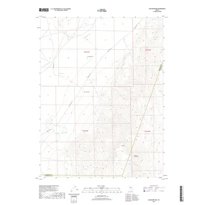
2018 Map of Cain Mountain
USGS Topo · Published 2018About this map
Cain Mtn and the northern reaches of the Augusta Mountains dominate this high-desert landscape in central Nevada. The geography is defined by the broad drainage of the Jersey Valley, where the Jersey Valley Wash courses through a basin marked by critical water sources for the region's ranching and transit history. Geothermal activity is a prominent feature of the terrain, as seen at Lower Ranch Hot Spring and Big Therm Hot Spring near the center of the quadrangle. Transportation through this arid corridor follows established routes like Jersey Valley Rd and Grass Valley Rd, which navigate between the steep slopes of Favret Canyon and the surrounding peaks. This 2018 survey provides a clear view of the complex jurisdictional boundary where Pershing, Lander, and Churchill Counties converge amidst the high-altitude desert springs including McCoy Springs.
Find a feature on this map
16 named features on this map. Tap any name to fly to it.
Don’t see what you’re looking for? This feature index may not catch every label — zoom into the map to look around manually.
Map Details
Editions of this 2018 Cain Mountain Map
This is the sole edition of this map. No revisions or reprints were ever made.
Other maps of this area

1932 · Sonoma Range
USGS Topo · 1:250,000

1939 · Sonoma Range
USGS Topo · 1:250,000

1955 · Millett
USGS Topo · 1:250,000

1955 · Winnemucca
USGS Topo · 1:250,000

1958 · Winnemucca
USGS Topo · 1:250,000

1959 · Millett
USGS Topo · 1:250,000

1961 · Cain Mountain
USGS Topo · 1:62,500

1961 · Mt. Moses
USGS Topo · 1:62,500

1962 · Winnemucca
USGS Topo · 1:250,000

1966 · Shoshone Meadows
USGS Topo · 1:62,500