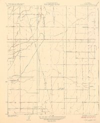
1927 Map of Cairns Corner
USGS Topo · Published 1927About this map
Agricultural development across the San Joaquin Valley is well-established in this 1925 survey, characterized by a complex network of irrigation features and rural school districts. The landscape is defined by the flow of Outside Creek and Inside Creek, supplemented by engineered waterways like the Rice Ditch and Hutchinson Ditch. These water sources supported a grid of farms and small community centers, most notably at Cairns Corner, where the Southern Pacific and California Central rail lines converge.
Find a feature on this map
19 named features on this map. Tap any name to fly to it.
Don’t see what you’re looking for? This feature index may not catch every label — zoom into the map to look around manually.
Map Details
Editions of this 1927 Cairns Corner Map
2 editions found
Other maps of this area

1925 · Rocky Hill
USGS Topo · 1:31,680

1925 · Tulare
USGS Topo · 1:31,680

1925 · Tipton
USGS Topo · 1:31,680

1926 · Exeter
USGS Topo · 1:31,680

1927 · Cairns Corner
USGS Topo · 1:31,680

1927 · Rocky Hill
USGS Topo · 1:31,680

1927 · Visalia
USGS Topo · 1:31,680

1927 · Tulare
USGS Topo · 1:31,680

1928 · Tipton
USGS Topo · 1:31,680

1928 · Woodville
USGS Topo · 1:31,680