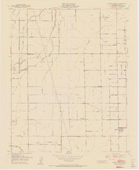
1951 Map of Cairns Corner
USGS Topo · Published 1951About this map
Agricultural development in the San Joaquin Valley is clearly defined on this sheet, where a rigorous grid of section lines and avenues like Seventh Ave and Strathmore Road organize the landscape. Small hubs like Spinks Corner and Cairns Corner serve as anchors for the surrounding farmsteads, while the small settlement of Plainview sits in the southeast corner. The complex hydrology of the region is evident in the many named waterways, including Outside Creek, Inside Creek, and the North Branch Tule River, which are supplemented by an extensive network of irrigation ditches.
Find a feature on this map
42 named features on this map. Tap any name to fly to it.
Don’t see what you’re looking for? This feature index may not catch every label — zoom into the map to look around manually.
Map Details
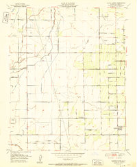
Editions of this 1951 Cairns Corner Map
2 editions found
Other maps of this area

1925 · Rocky Hill
USGS Topo · 1:31,680

1925 · Tulare
USGS Topo · 1:31,680

1925 · Tipton
USGS Topo · 1:31,680

1926 · Exeter
USGS Topo · 1:31,680

1927 · Cairns Corner
USGS Topo · 1:31,680

1927 · Rocky Hill
USGS Topo · 1:31,680

1927 · Visalia
USGS Topo · 1:31,680

1927 · Tulare
USGS Topo · 1:31,680

1928 · Tipton
USGS Topo · 1:31,680

1928 · Woodville
USGS Topo · 1:31,680