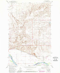
1950 Map of Calais
USGS Topo · Published 1989About this map
The Fort Peck Indian Reservation dominates this landscape along the northern banks of the Missouri River. Following the development of the Missouri River Basin in the mid-20th century, the area shows a distinct transition from the river bottomlands up into the dissected plateaus of Roosevelt County. The small settlement of Calais sits near the rail line that parallels the river, serving as a focal point for the surrounding rural territory. Resource extraction and infrastructure are visible through features like the Alton Mine, a Gravel Pit, and a prominent Water Tank. The drainage patterns are defined by several seasonal watercourses, including Elder Creek and Lake Creek, which carve through the high ground. Local water management is represented by the Bertino Res in the northeastern section of the quadrangle.
Find a feature on this map
11 named features on this map. Tap any name to fly to it.
Don’t see what you’re looking for? This feature index may not catch every label — zoom into the map to look around manually.
Map Details
Editions of this 1950 Calais Map
2 editions found
Other maps of this area

1909 · Smoke Creek
USGS Topo · 1:62,500

1912 · Smoke Creek
USGS Topo · 1:62,500

1914 · Brockton
USGS Topo · 1:62,500

1914 · Homestead
USGS Topo · 1:62,500

1947 · Rocky Point
USGS Topo · 1:24,000

1948 · Rocky Point
USGS Topo · 1:24,000

1948 · Fort Kipp
USGS Topo · 1:24,000

1949 · Fort Kipp
USGS Topo · 1:24,000

1950 · Coyote Coulee
USGS Topo · 1:24,000

1950 · Calais
USGS Topo · 1:24,000
Featured Places
- Brockton District, MT
- Fort Kipp District, MT
- Calais, Fort Kipp District
- Richland County, MT
- Roosevelt County, MT