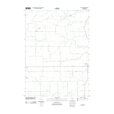
2010 Map of Calamine
USGS Topo · Published 2010About this map
The Pecatonica River winds through this Lafayette County landscape, serving as a focal point for the small settlements of Calamine and Truman. This 2010 survey illustrates a rural environment defined by its drainage systems, where numerous waterways like Wood Branch and Vinegar Branch converge. For those researching local family history, several prominent burial sites are clearly marked, including Kenneltown Cemetery near the center and Saint Marys Catholic Cemetery further south. The map reflects a classic Midwestern grid of county highways and local roads, such as County Hwy-D and Wardsville Rd, which connect the scattered communities of Seymour Corners and Avon. The transition between the North Fork Ames Branch and South Fork Ames Branch highlights the intricate network of creeks that have shaped the agricultural development and land use patterns of this corner of Wisconsin.
Find a feature on this map
44 named features on this map. Tap any name to fly to it.
Don’t see what you’re looking for? This feature index may not catch every label — zoom into the map to look around manually.
Map Details
Editions of this 2010 Calamine Map
This is the sole edition of this map. No revisions or reprints were ever made.
Other maps of this area

1902 · Mineral Point
USGS Topo · 1:125,000

1952 · Shullsburg
USGS Topo · 1:24,000

1952 · Calamine
USGS Topo · 1:24,000

1952 · Mineral Point
USGS Topo · 1:24,000

1952 · Belmont
USGS Topo · 1:24,000

1952 · New Diggings
USGS Topo · 1:24,000

1952 · Mifflin
USGS Topo · 1:24,000

1959 · Dubuque
USGS Topo · 1:250,000

1961 · Dubuque
USGS Topo · 1:250,000

1962 · Dubuque
USGS Topo · 1:250,000