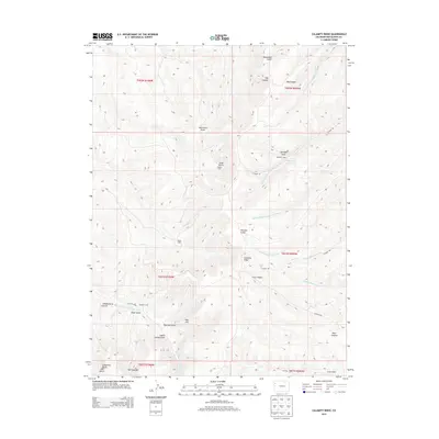
2013 Map of Calamity Ridge
USGS Topo · Published 2013About this map
Calamity Ridge defines the high ground of this Rio Blanco County landscape, where the plateau is deeply dissected by a network of gulches and draws. These drainage patterns, including Yanks Gulch and Shaft Gulch, dictate the placement of human activity in this arid region of western Colorado. The map reveals a history of seasonal or specialized occupation through several named sites such as Caldwell Camp, Kenney Camp, and structures like Hegwer Cabin. Large-scale natural features like the Cathedral Bluffs and The Shoulder stand as significant landmarks for those navigating the backcountry. Water sources, vital for both early settlers and wildlife, are marked at Indian Springs Draw and along the various forks of East Fork Greasewood Creek and Barcus Creek. This terrain remains largely served by a network of county routes, such as Co Road 89, which follow the natural contours of the canyons.
Find a feature on this map
42 named features on this map. Tap any name to fly to it.
Don’t see what you’re looking for? This feature index may not catch every label — zoom into the map to look around manually.
Map Details
Editions of this 2013 Calamity Ridge Map
This is the sole edition of this map. No revisions or reprints were ever made.
Other maps of this area

1907 · Rangely
USGS Topo · 1:125,000

1907 · White River
USGS Topo · 1:125,000

1910 · White River
USGS Topo · 1:125,000

1910 · Rangely
USGS Topo · 1:125,000

1952 · Wolf Ridge
USGS Topo · 1:24,000

1954 · Vernal
USGS Topo · 1:250,000

1956 · Grand Junction
USGS Topo · 1:250,000

1958 · Vernal
USGS Topo · 1:250,000

1959 · Grand Junction
USGS Topo · 1:250,000

1960 · Vernal
USGS Topo · 1:250,000