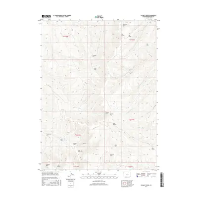
2016 Map of Calamity Ridge
USGS Topo · Published 2016About this map
Calamity Ridge and the Cathedral Bluffs dominate the high-elevation landscape of this Rio Blanco County region. This 2016 survey documents a terrain defined by complex drainage systems, where seasonal waters move through Monument Gulch, Hog Canyon, and Trail Gulch. Named features like Joe Ryan Draw and Shaft Gulch suggest a history of early land use and prospecting, while the network of Co RD 122 and Co RD 103 provides the primary access through the ridges and draws.
Find a feature on this map
41 named features on this map. Tap any name to fly to it.
Don’t see what you’re looking for? This feature index may not catch every label — zoom into the map to look around manually.
Map Details
Editions of this 2016 Calamity Ridge Map
This is the sole edition of this map. No revisions or reprints were ever made.
Other maps of this area

1907 · Rangely
USGS Topo · 1:125,000

1907 · White River
USGS Topo · 1:125,000

1910 · White River
USGS Topo · 1:125,000

1910 · Rangely
USGS Topo · 1:125,000

1952 · Wolf Ridge
USGS Topo · 1:24,000

1954 · Vernal
USGS Topo · 1:250,000

1956 · Grand Junction
USGS Topo · 1:250,000

1958 · Vernal
USGS Topo · 1:250,000

1959 · Grand Junction
USGS Topo · 1:250,000

1960 · Vernal
USGS Topo · 1:250,000