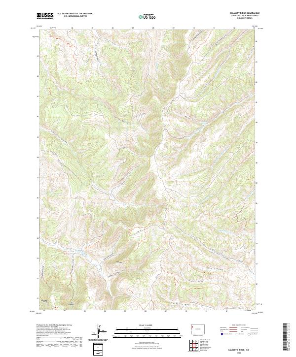
2022 Map of Calamity Ridge
USGS Topo · Published 2022About this map
Calamity Ridge dominates the central vertical axis of this landscape, serving as a prominent high-elevation spine between the extensive drainage networks of Joe Ryan Draw and Yanks Gulch. This 2022 survey of Rio Blanco County captures a complex topography of deep canyons and seasonal watercourses, defined by the towering Cathedral Bluffs and The Shoulder in the southwest corner. The area is marked by a history of resource access, evidenced by labels like Shaft Gulch and the winding route of Co RD 122 which follows the natural contours. Ranching and land management are implied by named landmarks such as Carls Hole and Indian Springs Draw, while the presence of Red Hill and its associated Red Hill Gulch highlights the distinctive geological character of the Colorado plateau.
Find a feature on this map
38 named features on this map. Tap any name to fly to it.
Don’t see what you’re looking for? This feature index may not catch every label — zoom into the map to look around manually.
Map Details
Editions of this 2022 Calamity Ridge Map
This is the sole edition of this map. No revisions or reprints were ever made.
Other maps of this area

1907 · Rangely
USGS Topo · 1:125,000

1907 · White River
USGS Topo · 1:125,000

1910 · White River
USGS Topo · 1:125,000

1910 · Rangely
USGS Topo · 1:125,000

1952 · Wolf Ridge
USGS Topo · 1:24,000

1954 · Vernal
USGS Topo · 1:250,000

1956 · Grand Junction
USGS Topo · 1:250,000

1958 · Vernal
USGS Topo · 1:250,000

1959 · Grand Junction
USGS Topo · 1:250,000

1960 · Vernal
USGS Topo · 1:250,000