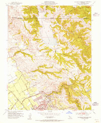
1953 Map of Calaveras Reservoir
USGS Topo · Published 1955About this map
The hills of the Diablo Range dominate this mid-century survey, defined by the expansive Calaveras Reservoir and the deep drainage of Alameda Creek. In the southwest, the valley floor shows the early urban footprint of Berryessa and Alum Rock before the rapid suburban expansion that would eventually characterize the region. The landscape reflects a mix of ranching heritage and water management, with Pueblo Lands of San Jose and the Ex Mission San Jose boundary marking historical land grants. Significant water infrastructure is visible, including a Diversion Dam and Diversion Tunnel feeding the reservoir. Local education and recreation are represented by the Air Point Sch and the San Jose Country Club, while the rugged eastern terrain is carved by Arroyo Hondo and Arroyo de los Coches.
Find a feature on this map
50 named features on this map. Tap any name to fly to it.
Don’t see what you’re looking for? This feature index may not catch every label — zoom into the map to look around manually.
Map Details
Editions of this 1953 Calaveras Reservoir Map
2 editions found
Other maps of this area

1889 · San Jose
USGS Topo · 1:62,500

1897 · San Jose
USGS Topo · 1:62,500

1897 · Mt. Hamilton
USGS Topo · 1:62,500

1899 · San Jose
USGS Topo · 1:62,500

1906 · Pleasanton
USGS Topo · 1:62,500

1907 · Tesla
USGS Topo · 1:62,500

1941 · Pleasanton
USGS Topo · 1:62,500

1942 · Mt. Hamilton
USGS Topo · 1:62,500

1942 · Altamont
USGS Topo · 1:62,500

1943 · Pleasanton
USGS Topo · 1:62,500