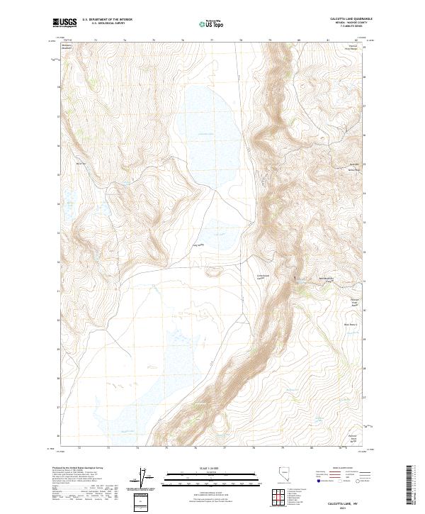
2021 Map of Calcutta Lake
USGS Topo · Published 2021About this map
Calcutta Lake and Middle Lake sit within a high-desert basin in Washoe County, where seasonal waters and scattered springs define the land's utility. The terrain is marked by the Painted Point Range to the north and east, with prominent elevations such as Mosquito Mountain and Yellow Peak overlooking the basin. This interior drainage system, including Horse Lake and Cow Lake, creates a specialized environment where water sources like Antelope Spring and Sage Hen Springs were vital for early range management and wildlife. The presence of Buck Pasture and several family-named or descriptive springs, such as Beebe Spring and Biebe Spring, indicates a landscape historically utilized for livestock grazing. Transport is limited to primitive routes like C R 34, which skirts the eastern edge of Long Valley.
Find a feature on this map
30 named features on this map. Tap any name to fly to it.
Don’t see what you’re looking for? This feature index may not catch every label — zoom into the map to look around manually.
Map Details
Editions of this 2021 Calcutta Lake Map
This is the sole edition of this map. No revisions or reprints were ever made.
Other maps of this area

1889 · Long Valley
USGS Topo · 1:250,000

1954 · Vya
USGS Topo · 1:250,000

1958 · Vya
USGS Topo · 1:250,000

1962 · Vya
USGS Topo · 1:250,000

1966 · Bald Mountain
USGS Topo · 1:24,000
1966 · Rye Creek
USGS Topo · 1:24,000

1966 · Massacre Lake NW
USGS Topo · 1:24,000

1966 · Massacre Lake
USGS Topo · 1:24,000
1966 · Mosquito Valley
USGS Topo · 1:24,000
1966 · Little Coleman Canyon
USGS Topo · 1:24,000