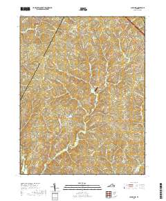
2019 Map of Caledonia
USGS Topo · Published 2019About this map
The boundary between Fluvanna Co and Goochland Co runs through this section of the Virginia Piedmont, defined by a landscape of creek-fed hollows and rural crossroads. Small settlements such as Tabscott, Caledonia, and Bula anchor the interior, while Hadensville sits at the northeastern edge. The terrain is deeply carved by water, with Mill Cr, Byrd Cr, and Little Byrd Cr draining toward the south.
Find a feature on this map
78 named features on this map. Tap any name to fly to it.
Don’t see what you’re looking for? This feature index may not catch every label — zoom into the map to look around manually.
Map Details
Editions of this 2019 Caledonia Map
This is the sole edition of this map. No revisions or reprints were ever made.
Other maps of this area

1890 · Goochland
USGS Topo · 1:125,000

1891 · Palmyra
USGS Topo · 1:125,000

1892 · Goochland
USGS Topo · 1:125,000

1895 · Palmyra
USGS Topo · 1:125,000

1897 · Palmyra
USGS Topo · 1:125,000

1942 · Pendleton
USGS Topo · 1:24,000

1943 · Goochland
USGS Topo · 1:31,680

1943 · Pendleton
USGS Topo · 1:31,680

1943 · South Anna
USGS Topo · 1:24,000

1943 · Richmond
USGS Topo · 1:250,000