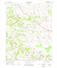
1974 Map of Caledonia
USGS Topo · Published 1977About this map
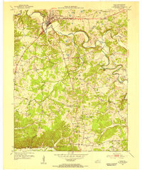
The Little River and the meandering course of the Sinking Fork define the landscape of the Trigg and Christian County line in the mid-1970s. The settlement of Caledonia sits central to this agricultural region, flanked by several smaller hubs like Julien and Peedee. This survey documents a quiet rural economy still tied to the land and its water sources, as seen at the Binns Mill site and various natural features like Boatwright Hole and Coon Cave Spring.
Find a feature on this map
38 named features on this map. Tap any name to fly to it.
Don’t see what you’re looking for? This feature index may not catch every label — zoom into the map to look around manually.
Map Details
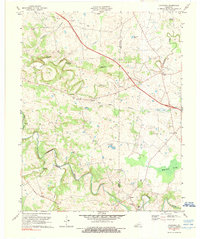
Editions of this 1974 Caledonia Map
2 editions found
Other maps of this area

1950 · Caledonia
USGS Topo · 1:24,000

1951 · Church Hill
USGS Topo · 1:24,000

1951 · Caledonia
USGS Topo · 1:24,000

1951 · Roaring Spring
USGS Topo · 1:24,000

1951 · Johnson Hollow
USGS Topo · 1:24,000

1951 · Herndon
USGS Topo · 1:24,000
1952 · Pleasant Green Hill
USGS Topo · 1:24,000
1953 · Gracey
USGS Topo · 1:24,000

1953 · Cobb
USGS Topo · 1:24,000
1953 · Cadiz
USGS Topo · 1:24,000