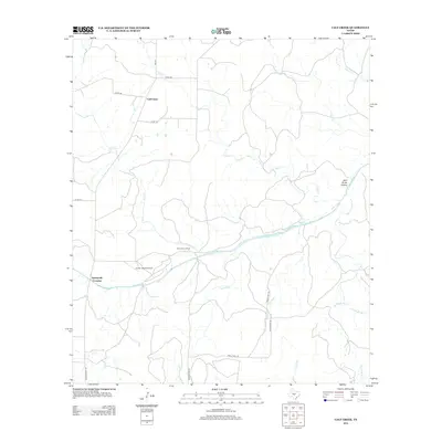
2012 Map of Calf Creek
USGS Topo · Published 2012About this map
The San Saba River cuts a prominent path through this Texas landscape, serving as the central hydrological feature for a region defined by ranching and rural aviation. Established ranching operations like the Block House Ranch sit near the river's banks, while the Smith I-Ranch Airport provides essential infrastructure for this sparsely populated territory. The terrain is deeply etched by numerous seasonal and perennial waterways, including the lengthy Calf Cr and Tenmile Cr, which flow through the rolling limestone country.
Find a feature on this map
22 named features on this map. Tap any name to fly to it.
Don’t see what you’re looking for? This feature index may not catch every label — zoom into the map to look around manually.
Map Details
Editions of this 2012 Calf Creek Map
This is the sole edition of this map. No revisions or reprints were ever made.
Other maps of this area

1887 · Mason
USGS Topo · 1:125,000

1892 · Eden
USGS Topo · 1:125,000

1894 · Brady
USGS Topo · 1:125,000

1894 · Mason
USGS Topo · 1:125,000

1896 · Eden
USGS Topo · 1:125,000

1954 · Brownwood
USGS Topo · 1:250,000

1954 · Llano
USGS Topo · 1:250,000

1955 · Llano
USGS Topo · 1:250,000

1956 · Llano
USGS Topo · 1:250,000

1963 · Brady SW
USGS Topo · 1:24,000