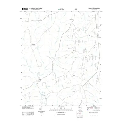
2011 Map of Calhoun Creek
USGS Topo · Published 2011About this map
Calhoun Mill stands as a focal point in this McCormick County landscape, situated where the Little River meets the local road network. The terrain is defined by an intricate web of watercourses, including Calhoun Creek, Hillbern Creek, and White Creek, which weave through a rural landscape marked by small settlements and family-linked landmarks. Traditional crossing points and junctions like Charleston Crossroads and Belcher Crossroads reflect the historic transportation patterns of the region, while the presence of Mars Bridge suggests established routes over the river. For genealogists and local historians, the map is a vital resource for locating community centers and resting places, such as Lebanon Cemetery, Hopewell Cemetery, and Calhoun Cemetery. The area is also crossed by several historic thoroughfares, including the Old Charleston Rd, which connects these disparate homesteads and smaller communities like Bethel and Bethiah.
Find a feature on this map
44 named features on this map. Tap any name to fly to it.
Don’t see what you’re looking for? This feature index may not catch every label — zoom into the map to look around manually.
Map Details
Editions of this 2011 Calhoun Creek Map
This is the sole edition of this map. No revisions or reprints were ever made.
Other maps of this area

1892 · Mc Cormick
USGS Topo · 1:125,000

1892 · Abbeville
USGS Topo · 1:125,000

1893 · Elberton
USGS Topo · 1:125,000

1906 · Crawfordville
USGS Topo · 1:125,000

1912 · Mc Cormick
USGS Topo · 1:125,000

1948 · Abbeville East
USGS Topo · 1:24,000

1948 · Verdery
USGS Topo · 1:24,000

1948 · Abbeville West
USGS Topo · 1:24,000

1949 · Abbeville
USGS Topo · 1:24,000

1949 · Calhoun Creek
USGS Topo · 1:24,000