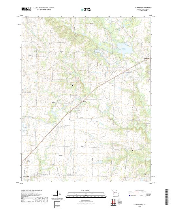
2021 Map of Calhoun West
USGS Topo · Published 2021About this map
The agricultural plains of western Henry County are defined by a network of north-flowing tributaries, including W Fork Tebo Cr and Sand Cr, which carve through the prairie landscape. The area is anchored by the historic settlement of Calhoun, situated at the eastern edge where the Katy Trl passes through. This recreational trail follows the route of the former Missouri–Kansas–Texas Railroad, cutting a diagonal path across the township through the small community of Lewis toward Clinton in the southwest.
Find a feature on this map
64 named features on this map. Tap any name to fly to it.
Don’t see what you’re looking for? This feature index may not catch every label — zoom into the map to look around manually.
Map Details
Editions of this 2021 Calhoun West Map
This is the sole edition of this map. No revisions or reprints were ever made.
Other maps of this area

1885 · Warrensburg
USGS Topo · 1:125,000

1887 · Clinton
USGS Topo · 1:125,000

1887 · Warrensburg
USGS Topo · 1:125,000

1894 · Warrensburg
USGS Topo · 1:125,000

1894 · Clinton
USGS Topo · 1:125,000

1947 · Jefferson City
USGS Topo · 1:250,000

1953 · Gaines
USGS Topo · 1:24,000
1953 · Calhoun East
USGS Topo · 1:24,000

1953 · Clinton South
USGS Topo · 1:24,000

1953 · Calhoun West
USGS Topo · 1:24,000