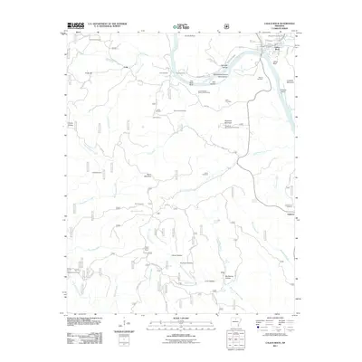
2011 Map of Calico Rock
USGS Topo · Published 2011About this map
Calico Rock anchors this portion of the White River valley, where the waterway carves deep bluffs and creates landforms like Creswell Island and Herd Island. The 2011 landscape reveals a territory defined by high ridges and secluded hollows, such as Picnic Hollow and Caney Hollow, that dictated the placement of long-standing family settlements. Traces of early transportation and community infrastructure are visible through Chesmond Ferry and numerous family burial grounds, including the Rorie, Cuff, and Harris Cemetery.
Find a feature on this map
79 named features on this map. Tap any name to fly to it.
Don’t see what you’re looking for? This feature index may not catch every label — zoom into the map to look around manually.
Map Details
Editions of this 2011 Calico Rock Map
This is the sole edition of this map. No revisions or reprints were ever made.
Other maps of this area

1890 · Mountain Home
USGS Topo · 1:125,000

1891 · Mountain Home
USGS Topo · 1:125,000

1892 · Mountain View
USGS Topo · 1:125,000

1894 · Mountain View
USGS Topo · 1:125,000

1894 · Mountain Home
USGS Topo · 1:125,000

1945 · Harrison
USGS Topo · 1:250,000

1949 · Harrison
USGS Topo · 1:250,000

1954 · Harrison
USGS Topo · 1:250,000

1956 · Russellville
USGS Topo · 1:250,000

1958 · Harrison
USGS Topo · 1:250,000