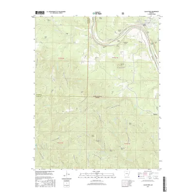
2017 Map of Calico Rock
USGS Topo · Published 2017About this map
Calico Rock and the winding White River define this corner of the Ozarks, where the river carves deep bluffs and creates landmarks like Herd Island and Creswell Island. The landscape is a network of ridges and hollows, including Kennedy Hollow and Hurricane Hollow, which provided the topography for isolated homesteads and community centers. A significant portion of the area is protected as the Ozark National Forest, crisscrossed by historic routes like the Syl. Horse Trail-McGowen and the Syl. Horse Trail-Hidden Spring. Genealogy researchers will find a high density of family burial grounds scattered across the terrain, including the Coots, Branscumb, Casteel, and Rorie cemeteries. The transition from the settlement at Optimus to the site of Old Optimus reflects the shifting patterns of rural residency in Izard and Stone counties over the decades.
Find a feature on this map
73 named features on this map. Tap any name to fly to it.
Don’t see what you’re looking for? This feature index may not catch every label — zoom into the map to look around manually.
Map Details
Editions of this 2017 Calico Rock Map
This is the sole edition of this map. No revisions or reprints were ever made.
Other maps of this area

1890 · Mountain Home
USGS Topo · 1:125,000

1891 · Mountain Home
USGS Topo · 1:125,000

1892 · Mountain View
USGS Topo · 1:125,000

1894 · Mountain View
USGS Topo · 1:125,000

1894 · Mountain Home
USGS Topo · 1:125,000

1945 · Harrison
USGS Topo · 1:250,000

1949 · Harrison
USGS Topo · 1:250,000

1954 · Harrison
USGS Topo · 1:250,000

1956 · Russellville
USGS Topo · 1:250,000

1958 · Harrison
USGS Topo · 1:250,000