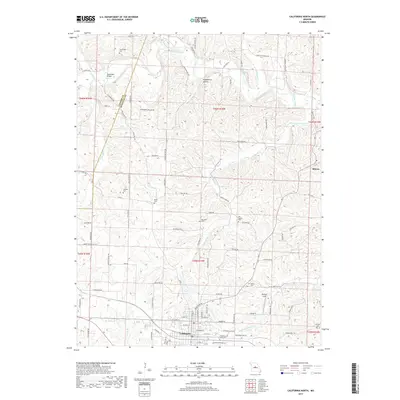
2017 Map of California North
USGS Topo · Published 2017About this map
The northern reaches of California anchor this survey of Moniteau County, where the topography transitions into a network of creek drainages. The landscape is notably defined by its many family and community burial grounds, including the Rohrback Cem, Strickfaden Cem, and Old Salem Cem, which serve as vital markers for local genealogical research. To the north, Moniteau Creek winds through the terrain, joined by tributaries such as Howard Cr and Schuaf Cr.
Find a feature on this map
102 named features on this map. Tap any name to fly to it.
Don’t see what you’re looking for? This feature index may not catch every label — zoom into the map to look around manually.
Map Details
Editions of this 2017 California North Map
This is the sole edition of this map. No revisions or reprints were ever made.
Other maps of this area

1886 · Jefferson City
USGS Topo · 1:125,000

1888 · Boonville
USGS Topo · 1:125,000

1894 · Jefferson City
USGS Topo · 1:125,000

1947 · Jefferson City
USGS Topo · 1:250,000

1948 · Centertown
USGS Topo · 1:62,500

1948 · Columbia
USGS Topo · 1:62,500
1949 · Centertown
USGS Topo · 1:62,500

1950 · Columbia
USGS Topo · 1:62,500

1951 · California South
USGS Topo · 1:24,000

1951 · Latham
USGS Topo · 1:24,000