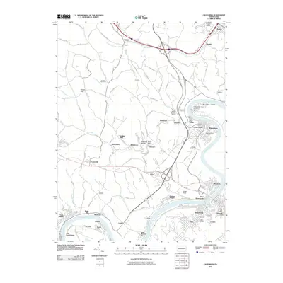
2010 Map of California
USGS Topo · Published 2010About this map
The Monongahela River carves a deep, winding path through this corner of Washington County, defining the development of riverfront boroughs like California, West Brownsville, and Coal Center. This industrial and educational corridor is anchored by the California University of Pennsylvania campus, while the surrounding landscape is marked by numerous coal-era settlements such as Vesta Heights, Daisytown, and Marchandville. The river's influence is evident at Greenfield Bend and the historical site of the Simpson Ferry.
Find a feature on this map
138 named features on this map. Tap any name to fly to it.
Don’t see what you’re looking for? This feature index may not catch every label — zoom into the map to look around manually.
Map Details
Editions of this 2010 California Map
This is the sole edition of this map. No revisions or reprints were ever made.
Other maps of this area

1900 · Masontown
USGS Topo · 1:62,500

1901 · Amity
USGS Topo · 1:62,500

1901 · Waynesburg
USGS Topo · 1:62,500

1902 · Brownsville
USGS Topo · 1:62,500

1903 · Masontown
USGS Topo · 1:62,500

1904 · Amity
USGS Topo · 1:62,500

1904 · Waynesburg
USGS Topo · 1:62,500

1906 · Brownsville
USGS Topo · 1:62,500

1931 · Brownsville
USGS Topo · 1:62,500

1931 · Masontown
USGS Topo · 1:62,500