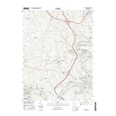
2016 Map of California
USGS Topo · Published 2016About this map
The Monongahela River carves a deep valley through this corner of Washington and Fayette Counties, serving as the primary corridor for industry and settlement. Along its banks, the borough of California is anchored by the California University of Pennsylvania, while neighboring river towns like Coal Center, Brownsville, and West Brownsville follow the water's bend. The landscape is defined by the sharp transition from the industrial riverfront to the upland ridges, where smaller hamlets such as Daisytown, Crescent Heights, and Walkertown sit atop the plateaus. Evidence of the region’s long history is found in numerous hilltop burial grounds, including the Old Pioneer Cemetery and Zion Cemetery. Transportation networks reflect the terrain, with the Norfolk Southern line hugging the western riverbank while roads like National Pike and Bentleyville Road connect the inland mining and farming communities.
Find a feature on this map
224 named features on this map. Tap any name to fly to it.
Don’t see what you’re looking for? This feature index may not catch every label — zoom into the map to look around manually.
Map Details
Editions of this 2016 California Map
This is the sole edition of this map. No revisions or reprints were ever made.
Other maps of this area

1900 · Masontown
USGS Topo · 1:62,500

1901 · Amity
USGS Topo · 1:62,500

1901 · Waynesburg
USGS Topo · 1:62,500

1902 · Brownsville
USGS Topo · 1:62,500

1903 · Masontown
USGS Topo · 1:62,500

1904 · Amity
USGS Topo · 1:62,500

1904 · Waynesburg
USGS Topo · 1:62,500

1906 · Brownsville
USGS Topo · 1:62,500

1931 · Brownsville
USGS Topo · 1:62,500

1931 · Masontown
USGS Topo · 1:62,500