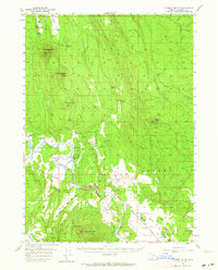
1956 Map of Calimus Butte
USGS Topo · Published 1964About this map
The Sprague River winds through the heart of the Winema National Forest, carving the deep Sprague River Canyon near Lone Pine. This mid-century survey illustrates a landscape transitioning from pioneer ranching to modern forestry and water management. Isolated homesteads such as the McCready Ranch, Wolff Ranch, and the Ray Ranch (Ruins) mark the valley floor, while an extensive Old Railroad Grade snakes across the northern ridges, indicating the era's timber extraction routes.
Find a feature on this map
44 named features on this map. Tap any name to fly to it.
Don’t see what you’re looking for? This feature index may not catch every label — zoom into the map to look around manually.
Map Details
Editions of this 1956 Calimus Butte Map
2 editions found
Other maps of this area

1889 · Klamath
USGS Topo · 1:250,000

1894 · Klamath
USGS Topo · 1:250,000

1955 · Klamath Falls
USGS Topo · 1:250,000

1956 · Calimus Butte
USGS Topo · 1:62,500

1957 · Chiloquin
USGS Topo · 1:62,500

1957 · Klamath Marsh
USGS Topo · 1:62,500

1957 · Swan Lake
USGS Topo · 1:62,500

1957 · Lenz
USGS Topo · 1:62,500

1957 · Modoc Point
USGS Topo · 1:62,500

1958 · Klamath Falls
USGS Topo · 1:250,000