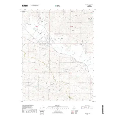
2018 Map of Calistoga
USGS Topo · Published 2018About this map
Calistoga serves as the focal point of this upper Napa Valley landscape, where the valley floor meets the steep ascent of the Mayacmas Mountains. The map highlights the unique geothermal character of the region with the Old Faithful Geyser of California, situated near the confluence of Garnett Cr and Blossom Cr. To the south, the terrain rises sharply toward Diamond Mtn and Coyote Peak, cut by deep drainages like Hoisting Works Canyon and Jericho Canyon. This geography influenced a settlement pattern that follows the Napa River and the historic Silverado Trl, while smaller communities like Larkmead established themselves along the rail and road corridors. Cultural heritage is preserved at the Old Pioneer Cem and Pioneer Cem, while a network of paths such as the Ritchey Canyon Trl and History Trl trace the rugged transitions between Napa and Sonoma counties.
Find a feature on this map
115 named features on this map. Tap any name to fly to it.
Don’t see what you’re looking for? This feature index may not catch every label — zoom into the map to look around manually.
Map Details
Editions of this 2018 Calistoga Map
This is the sole edition of this map. No revisions or reprints were ever made.
Other maps of this area

1902 · Napa
USGS Topo · 1:125,000

1916 · Santa Rosa
USGS Topo · 1:62,500

1927 · Calistoga
USGS Topo · 1:62,500

1942 · Sonoma
USGS Topo · 1:62,500

1942 · St. Helena
USGS Topo · 1:62,500

1943 · Calistoga
USGS Topo · 1:62,500

1944 · Santa Rosa
USGS Topo · 1:62,500

1945 · Calistoga
USGS Topo · 1:62,500

1945 · St. Helena
USGS Topo · 1:62,500

1947 · Santa Rosa
USGS Topo · 1:250,000