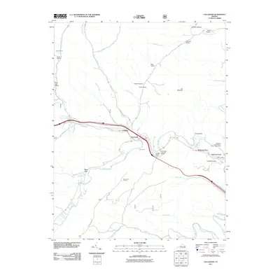
2011 Map of Callaghan
USGS Topo · Published 2011About this map
The Humpback Covered Bridge stands as a landmark over the waters of Dunlap Creek, anchoring a landscape defined by deep ridges and hollows in western Virginia. Settled areas like Callaghan, Stonewall, and Dunlap Beach follow the natural path of the creek valley, while newer developments such as Oakwood Forest and Westwood Place appear further east. The map provides significant detail for genealogists, marking the Hoke Cemetery near Ogle Creek and the Helmintoller Cemetery on the high ground south of the main creek. Industrial and infrastructure markers, including the Mud Tunnel and the Westvaco Number Two Flyash Lagoon Dam, highlight the intersection of the rugged Appalachian terrain with the regional economy. Numerous family-named hollows, such as Kittenger Hollow and Pond Suck Hollow, illustrate the long-standing local nomenclature of Alleghany County.
Find a feature on this map
40 named features on this map. Tap any name to fly to it.
Don’t see what you’re looking for? This feature index may not catch every label — zoom into the map to look around manually.
Map Details
Editions of this 2011 Callaghan Map
This is the sole edition of this map. No revisions or reprints were ever made.
Other maps of this area

1887 · Lewisburg
USGS Topo · 1:125,000

1891 · Lewisburg
USGS Topo · 1:125,000

1894 · Natural Bridge
USGS Topo · 1:125,000

1913 · Eagle Rock
USGS Topo · 1:48,000

1915 · Eagle Rock
USGS Topo · 1:62,500

1921 · Callaghan
USGS Topo · 1:48,000

1923 · Callaghan
USGS Topo · 1:62,500

1929 · Falling Spring
USGS Topo · 1:24,000

1932 · Falling Spring
USGS Topo · 1:31,680

1945 · Clifton Forge
USGS Topo · 1:62,500