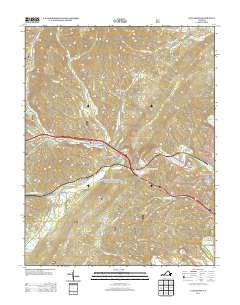
2013 Map of Callaghan
USGS Topo · Published 2013About this map
Callaghan and Stonewall anchor this Alleghany County landscape, where the transport corridor of Interstate 64 and the CSX railroad follow the natural path carved by Dunlap Cr. The terrain is defined by a series of steep drainages and family-named hollows, including Bear Hollow and Kittenger Hollow, which rise toward the heights of Lick Mountain and Lukes Mountain. Near the confluence of these waterways, the Humpback Covered Bridge stands as a notable landmark, while the Mud Tunnel reflects the engineering required to navigate the mountain passages. To the east, the map captures the residential expansion of Westwood Place and Oakwood Forest on the outskirts of Covington. The hydrology is particularly dense, with numerous tributaries like Thorny Br and Harmon Run feeding into the Jackson River, illustrating the complex drainage patterns of the Virginia highlands during the early 21st century.
Find a feature on this map
46 named features on this map. Tap any name to fly to it.
Don’t see what you’re looking for? This feature index may not catch every label — zoom into the map to look around manually.
Map Details
Editions of this 2013 Callaghan Map
This is the sole edition of this map. No revisions or reprints were ever made.
Other maps of this area

1887 · Lewisburg
USGS Topo · 1:125,000

1891 · Lewisburg
USGS Topo · 1:125,000

1894 · Natural Bridge
USGS Topo · 1:125,000

1913 · Eagle Rock
USGS Topo · 1:48,000

1915 · Eagle Rock
USGS Topo · 1:62,500

1921 · Callaghan
USGS Topo · 1:48,000

1923 · Callaghan
USGS Topo · 1:62,500

1929 · Falling Spring
USGS Topo · 1:24,000

1932 · Falling Spring
USGS Topo · 1:31,680

1945 · Clifton Forge
USGS Topo · 1:62,500