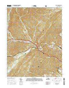
2016 Map of Callaghan
USGS Topo · Published 2016About this map
The Humpback Covered Bridge stands as a focal point in this landscape of high ridges and narrow creek valleys west of Covington. Settled communities like Callaghan and Moss Run follow the path of Dunlap Creek, while residential developments such as Westwood Place and Oakwood Forest cluster near the city limits. The terrain is defined by significant elevations, including Peters Mountain and Oliver Mtn, much of which is preserved within the George Washington National Forest. Local history is anchored by family-named landmarks and resting places like Hoke Cem and Helmintoller Cem. The industrial footprint of the region is evidenced by the Westvaco Number Two Flyash Lagoon, situated near the banks of the Jackson River.
Find a feature on this map
52 named features on this map. Tap any name to fly to it.
Don’t see what you’re looking for? This feature index may not catch every label — zoom into the map to look around manually.
Map Details
Editions of this 2016 Callaghan Map
This is the sole edition of this map. No revisions or reprints were ever made.
Other maps of this area

1887 · Lewisburg
USGS Topo · 1:125,000

1891 · Lewisburg
USGS Topo · 1:125,000

1894 · Natural Bridge
USGS Topo · 1:125,000

1913 · Eagle Rock
USGS Topo · 1:48,000

1915 · Eagle Rock
USGS Topo · 1:62,500

1921 · Callaghan
USGS Topo · 1:48,000

1923 · Callaghan
USGS Topo · 1:62,500

1929 · Falling Spring
USGS Topo · 1:24,000

1932 · Falling Spring
USGS Topo · 1:31,680

1945 · Clifton Forge
USGS Topo · 1:62,500