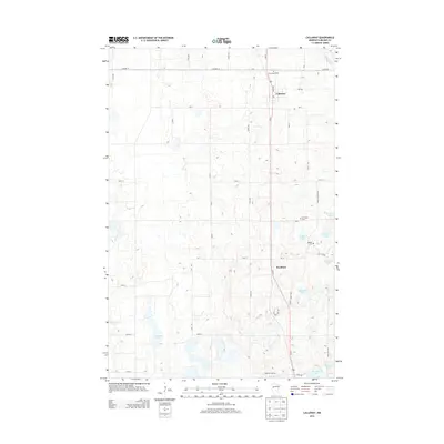
2013 Map of Callaway
USGS Topo · Published 2013About this map
Callaway sits at the heart of this Becker County landscape, where the Us-59 corridor provides a primary north-south artery through a terrain densely pockmarked by glacial depressions. The map records a transition from the structured street grid of the village to the irregular lake country of the surrounding prairie and woodland. Small agrarian settlements and burial grounds, such as Westbury and Saint Marys Cem, are interspersed between numerous water bodies including Tamarac Lake and Gandrud Lake. The Buffalo River flows through the northeastern corner, anchoring a drainage pattern that feeds into several large lakes like Cravath Lake and Torgerson Lake. The network of section-line roads, including Co HWY-14 and 280 St, reveals a landscape deeply organized by township-and-range surveying, yet defined by the natural contours of its many lakes and wetlands.
Find a feature on this map
40 named features on this map. Tap any name to fly to it.
Don’t see what you’re looking for? This feature index may not catch every label — zoom into the map to look around manually.
Map Details
Editions of this 2013 Callaway Map
This is the sole edition of this map. No revisions or reprints were ever made.
Other maps of this area

1918 · Flom
USGS Topo · 1:62,500

1952 · Grand Forks
USGS Topo · 1:250,000

1953 · Fargo
USGS Topo · 1:250,000

1953 · Brainerd
USGS Topo · 1:250,000

1954 · Bemidji
USGS Topo · 1:250,000

1956 · Fargo
USGS Topo · 1:250,000

1956 · Grand Forks
USGS Topo · 1:250,000

1957 · Brainerd
USGS Topo · 1:250,000

1957 · Bemidji
USGS Topo · 1:250,000

1958 · Bemidji
USGS Topo · 1:250,000