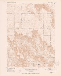
1951 Map of Callaway NW
USGS Topo · Published 1952About this map
West Cliff Table dominates the central landscape of this Custer County survey, illustrating the high plains topography of central Nebraska during the mid-century. The settlement pattern is defined by a dense network of country schools, including Center Sch, Fairview Sch, and Sunflower Sch, which served the rural agricultural population of the era. The presence of Cliff Ch and an adjacent Cem indicates the site of a community hub situated near the distinct escarpments of the tableland.
Find a feature on this map
15 named features on this map. Tap any name to fly to it.
Don’t see what you’re looking for? This feature index may not catch every label — zoom into the map to look around manually.
Map Details
Editions of this 1951 Callaway NW Map
2 editions found
Other maps of this area

1948 · Linscott
USGS Topo · 1:62,500

1950 · Linscott
USGS Topo · 1:62,500

1951 · Callaway NW
USGS Topo · 1:24,000

1951 · Anselmo
USGS Topo · 1:24,000

1951 · Merna
USGS Topo · 1:24,000

1951 · Anselmo SW
USGS Topo · 1:24,000

1951 · Callaway SE
USGS Topo · 1:24,000

1951 · Callaway
USGS Topo · 1:24,000

1954 · North Platte
USGS Topo · 1:250,000

1955 · Broken Bow
USGS Topo · 1:250,000