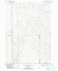
1964 Map of Camas
USGS Topo · Published 1993About this map
Dutch Flat dominates the northwestern portion of this 1964 Idaho survey, where the convergence of Beaver Creek and Camas Creek shapes the local landscape. The small settlement of Camas is situated in the south, near the boundary between Clark County and Jefferson County. This area reflects a quiet, rural infrastructure defined by water management and transit, including a Gaging Station and the specific intersection at Jones Crossing.
Find a feature on this map
14 named features on this map. Tap any name to fly to it.
Don’t see what you’re looking for? This feature index may not catch every label — zoom into the map to look around manually.
Map Details
Editions of this 1964 Camas Map
2 editions found
Other maps of this area

1955 · Dubois
USGS Topo · 1:250,000

1955 · Idaho Falls
USGS Topo · 1:250,000

1958 · Dubois
USGS Topo · 1:250,000

1958 · Idaho Falls
USGS Topo · 1:250,000

1964 · Dubois NW
USGS Topo · 1:24,000

1964 · Lone Butte
USGS Topo · 1:24,000

1964 · Dubois NE
USGS Topo · 1:24,000
1964 · Hamer
USGS Topo · 1:24,000

1964 · Camas
USGS Topo · 1:24,000

1964 · Rays Lake
USGS Topo · 1:24,000