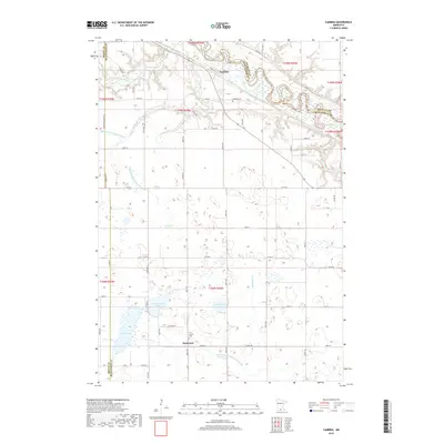
2019 Map of Cambria
USGS Topo · Published 2019About this map
The Minnesota River and its meandering valley dominate the northern landscape of this region where Brown and Nicollet counties meet. The small settlement of Cambria sits perched above the river bluffs, overlooking the complex wetlands and bends that define this stretch of the water. To the south, the terrain transitions into a prairie pothole landscape characterized by numerous natural basins, including Lieberg Lake, Armstrong Lake, and the distinctive Solberg Lakebed. This area reflects a highly managed hydrologic system, evidenced by numerous drainage projects like Judicial Ditch Number 48 and Judicial Ditch Number 36. These features illustrate the conversion of the wet prairie into productive agricultural land centered around communities like Butternut, where Our Saviors Cemetery serves as a lasting landmark of the local heritage.
Find a feature on this map
74 named features on this map. Tap any name to fly to it.
Don’t see what you’re looking for? This feature index may not catch every label — zoom into the map to look around manually.
Map Details
Editions of this 2019 Cambria Map
This is the sole edition of this map. No revisions or reprints were ever made.
Other maps of this area

1951 · Mankato West
USGS Topo · 1:62,500

1953 · New Ulm
USGS Topo · 1:250,000

1957 · New Ulm
USGS Topo · 1:250,000

1958 · New Ulm
USGS Topo · 1:250,000

1964 · New Ulm
USGS Topo · 1:24,000

1964 · Courtland
USGS Topo · 1:24,000

1965 · Madelia
USGS Topo · 1:24,000

1965 · Hanska
USGS Topo · 1:24,000

1965 · Perth
USGS Topo · 1:24,000

1965 · Cambria
USGS Topo · 1:24,000