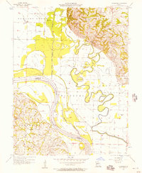
1956 Map of Cambridge
USGS Topo · Published 1957About this map
The Missouri River and its tributary, the Chariton River, define this landscape at the intersection of Chariton and Saline Counties. The map documents a complex hydrological environment where the Old Channel Chariton River winds through the bottomlands alongside artificial interventions like the Levee, Hayes Cutoff, and Big Cutoff. These engineering efforts highlight the era's focus on managing floodplains for agriculture, leaving behind oxbows like Smith Lake and Whiteside Lake.
Find a feature on this map
31 named features on this map. Tap any name to fly to it.
Don’t see what you’re looking for? This feature index may not catch every label — zoom into the map to look around manually.
Map Details
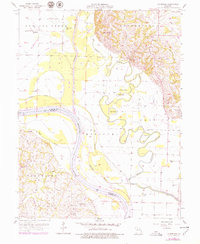
Editions of this 1956 Cambridge Map
2 editions found
Other maps of this area

1890 · Glasgow
USGS Topo · 1:125,000

1890 · Marshall
USGS Topo · 1:125,000

1892 · Marshall
USGS Topo · 1:125,000

1901 · Marshall
USGS Topo · 1:125,000

1940 · Marshall
USGS Topo · 1:62,500

1944 · Marshall
USGS Topo · 1:62,500

1947 · Glasgow
USGS Topo · 1:62,500

1951 · Brunswick East
USGS Topo · 1:24,000
1951 · New Frankfort
USGS Topo · 1:24,000

1953 · Moberly
USGS Topo · 1:250,000