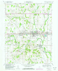
1960 Map of Cambridge City
USGS Topo · Published 1982About this map
Cambridge City serves as a central hub on this 1960s-era landscape, where the Whitewater River and the National Road intersect a network of established Indiana rail lines. The settlement pattern shows a high density of civic and religious institutions, including Locust Grove Ch, Zion Ch, and numerous cemeteries such as Riverside Cem and Friends Cem. The influence of the transportation corridor is evident in the alignment of towns like Dublin, Mount Auburn, and East Germantown, which were well-established before the mid-century period of photorevision. Educational facilities like Lincoln High Sch and Crietz Park Sch are positioned among residential blocks, while the outlying areas maintain a rural character defined by agricultural fields and watercourses like Symonds Creek and Martindale Creek. This survey captures the transition from traditional rail-based commerce to the expanding highway system, while preserving the location of early schools and family-named landmarks.
Find a feature on this map
68 named features on this map. Tap any name to fly to it.
Don’t see what you’re looking for? This feature index may not catch every label — zoom into the map to look around manually.
Map Details
Editions of this 1960 Cambridge City Map
2 editions found
Other maps of this area

1948 · Lewisville
USGS Topo · 1:24,000

1950 · New Castle East
USGS Topo · 1:24,000

1950 · Lewisville
USGS Topo · 1:24,000

1953 · Cincinnati
USGS Topo · 1:250,000

1956 · Brownsville
USGS Topo · 1:24,000

1956 · Connersville
USGS Topo · 1:24,000

1957 · Cincinnati
USGS Topo · 1:250,000

1959 · Falmouth
USGS Topo · 1:24,000

1960 · New Castle East
USGS Topo · 1:24,000
1960 · Hagerstown
USGS Topo · 1:24,000