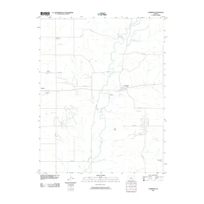
2010 Map of Cambridge
USGS Topo · Published 2010About this map
Burden and Cambridge anchor this portion of the Flint Hills, where the landscape is defined by a dense network of watercourses and rural burial grounds. The meandering path of Grouse Creek dominates the central terrain, fed by numerous tributaries including Blue Branch, Cedar Creek, and Coon Creek. This geography created a dispersed settlement pattern reflected in the scattered location of community sites like Grand Prairie Cemetery and Windsor Cemetery.
Find a feature on this map
31 named features on this map. Tap any name to fly to it.
Don’t see what you’re looking for? This feature index may not catch every label — zoom into the map to look around manually.
Map Details
Editions of this 2010 Cambridge Map
This is the sole edition of this map. No revisions or reprints were ever made.
Other maps of this area

1889 · Burden
USGS Topo · 1:125,000

1955 · Wichita
USGS Topo · 1:250,000

1958 · Wichita
USGS Topo · 1:250,000

1962 · Grand Summit
USGS Topo · 1:24,000

1962 · Dexter
USGS Topo · 1:24,000
1962 · Dexter NE
USGS Topo · 1:24,000

1962 · Cambridge
USGS Topo · 1:24,000

1964 · Cambridge NW
USGS Topo · 1:24,000
1964 · Cambridge NE
USGS Topo · 1:24,000

1964 · Burden
USGS Topo · 1:24,000