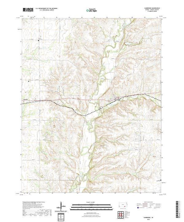
2022 Map of Cambridge
USGS Topo · Published 2022About this map
The Flint Hills landscape of eastern Cowley County is defined by a dense network of watercourses, where Grouse Creek and its many tributaries, such as Cedar Cr and Silver Cr, carve through the terrain. The small community of Cambridge serves as a central point, anchored by local thoroughfares like W Main St and Pearl St. To the west, the edge of Burden appears, illustrating the sparse but organized settlement pattern characteristic of this cattle-country region.
Find a feature on this map
41 named features on this map. Tap any name to fly to it.
Don’t see what you’re looking for? This feature index may not catch every label — zoom into the map to look around manually.
Map Details
Editions of this 2022 Cambridge Map
This is the sole edition of this map. No revisions or reprints were ever made.
Other maps of this area

1889 · Burden
USGS Topo · 1:125,000

1955 · Wichita
USGS Topo · 1:250,000

1958 · Wichita
USGS Topo · 1:250,000

1962 · Grand Summit
USGS Topo · 1:24,000

1962 · Dexter
USGS Topo · 1:24,000
1962 · Dexter NE
USGS Topo · 1:24,000

1962 · Cambridge
USGS Topo · 1:24,000

1964 · Cambridge NW
USGS Topo · 1:24,000
1964 · Cambridge NE
USGS Topo · 1:24,000

1964 · Burden
USGS Topo · 1:24,000