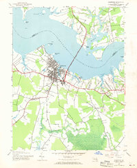
1943 Map of Cambridge
USGS Topo · Published 1970About this map
Cambridge serves as the focal point of this Eastern Shore survey, situated where the expansive Choptank River meets the Chesapeake's intricate network of tidal creeks. The settlement pattern reflects a deeply rooted maritime and agricultural economy, with the Choptank River Bridge providing a vital link to Talbot County. In the hinterlands of Dorchester County, small communities like Christs Rock and Mt Holly are connected by rural roads, while the southern reaches transition into the marshy wetlands near the Little Blackwater River. This 1943 documentation captures the region before mid-century modernization, preserving the locations of local landmarks such as the County Fairgrounds, the State Hospital, and the path of the Pennsylvania railroad. Genealogists will find significant value in the identified burial grounds, including Bethel Cem, Greenlawn Cem, and Dorchester Cem.
Find a feature on this map
34 named features on this map. Tap any name to fly to it.
Don’t see what you’re looking for? This feature index may not catch every label — zoom into the map to look around manually.
Map Details
Editions of this 1943 Cambridge Map
3 editions found
Other maps of this area

1898 · Choptank
USGS Topo · 1:125,000

1898 · St. Marys
USGS Topo · 1:125,000

1903 · Nanticoke
USGS Topo · 1:62,500

1904 · Oxford
USGS Topo · 1:62,500

1905 · Crapo
USGS Topo · 1:62,500

1905 · Hurlock
USGS Topo · 1:62,500

1906 · St. Marys
USGS Topo · 1:125,000

1908 · Choptank
USGS Topo · 1:125,000

1942 · Oxford
USGS Topo · 1:31,680

1942 · Church Creek
USGS Topo · 1:24,000