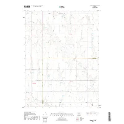
2017 Map of Cambridge NE
USGS Topo · Published 2017About this map
Stowe Cem sits on the northern edge of this high plains landscape, overlooking a series of drainage basins that define the border between Frontier and Gosper counties. The terrain is characterized by a sophisticated network of small-scale water management, evidenced by numerous named impoundments such as Monter Reservoir, Bergstresser Reservoir, and Flamming Reservoir. These man-made features are vital for agriculture in this arid region, collecting runoff from the intermittent flows of Muddy Cr and its western branch, W Muddy Cr. To the southwest, the topography deepens into Deer Creek Canyon, where Deer Cr begins its descent. The map reveals a highly structured grid of section roads, including RD 736 and RD 416, which provide access to the remote homesteads and ranches that sustain the local rural economy.
Find a feature on this map
38 named features on this map. Tap any name to fly to it.
Don’t see what you’re looking for? This feature index may not catch every label — zoom into the map to look around manually.
Map Details
Editions of this 2017 Cambridge NE Map
This is the sole edition of this map. No revisions or reprints were ever made.
Other maps of this area

1896 · Lexington
USGS Topo · 1:125,000

1896 · Arapahoe
USGS Topo · 1:125,000

1898 · Arapahoe
USGS Topo · 1:125,000

1899 · Lexington
USGS Topo · 1:125,000

1902 · Gothenburg
USGS Topo · 1:125,000

1954 · McCook
USGS Topo · 1:250,000

1955 · Grand Island
USGS Topo · 1:250,000

1956 · Cambridge
USGS Topo · 1:24,000

1956 · Medicine Creek Dam
USGS Topo · 1:24,000

1957 · McCook
USGS Topo · 1:250,000