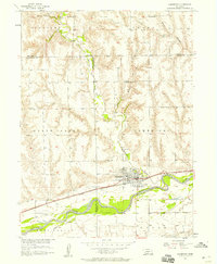
1956 Map of Cambridge
USGS Topo · Published 1957About this map
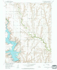
Cambridge serves as the focal point of this mid-century survey, situated at the confluence of Medicine Creek and the Republican River. The landscape is a study in Western Nebraska water management, showing the Bartley Canal and a levee system protecting the river valley bottomlands. The town's infrastructure is clearly delineated, from the Chicago Burlington and Quincy railroad line and the Quincy roadway to the local Radio Tower and Sewage Disposal plant.
Find a feature on this map
26 named features on this map. Tap any name to fly to it.
Don’t see what you’re looking for? This feature index may not catch every label — zoom into the map to look around manually.
Map Details
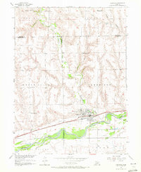
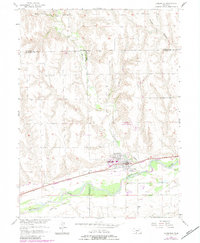
Editions of this 1956 Cambridge Map
3 editions found
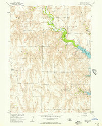
Other maps of this area

1954 · McCook
USGS Topo · 1:250,000
1956 · Freedom
USGS Topo · 1:24,000
1956 · Medicine Creek Dam
USGS Topo · 1:24,000
1956 · Bartley
USGS Topo · 1:24,000

1957 · McCook
USGS Topo · 1:250,000
1957 · Danbury NE
USGS Topo · 1:24,000

1958 · McCook
USGS Topo · 1:250,000
1958 · Danbury NE
USGS Topo · 1:24,000
1958 · Wilsonville NW
USGS Topo · 1:24,000
1958 · Wilsonville NE
USGS Topo · 1:24,000