
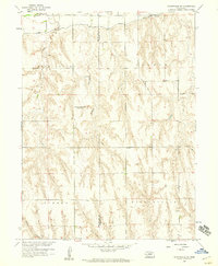
1957 Map of Danbury NE
USGS Topo · Published 1983About this map
Bartley stands as the primary hub of this Red Willow County landscape, where the Burlington Northern railroad runs parallel to the Republican River. The 1950s era irrigation infrastructure is prominent throughout the river valley, featuring the Bartley Canal and several engineered Siphons designed to manage water across the local topography. Further south, the map reveals a sparsely populated agricultural upland where rural education was once decentralized, as evidenced by three decommissioned schoolhouses: Valley Center Sch, School Creek Sch, and School No 60. The presence of the Trinity Cem and scattered Gravel Pits alongside small settlements like Berger provides a detailed look at the mid-century infrastructure and community layout of southwest Nebraska before later consolidation changed the rural school system.
Find a feature on this map
19 named features on this map. Tap any name to fly to it.
Don’t see what you’re looking for? This feature index may not catch every label — zoom into the map to look around manually.
Map Details
Editions of this 1957 Danbury NE Map
This is the sole edition of this map. No revisions or reprints were ever made.
Other maps of this area

1954 · McCook
USGS Topo · 1:250,000

1956 · Cambridge
USGS Topo · 1:24,000

1956 · Bartley
USGS Topo · 1:24,000

1957 · McCook
USGS Topo · 1:250,000

1957 · Shippee
USGS Topo · 1:24,000

1957 · Danbury
USGS Topo · 1:24,000

1957 · Lebanon
USGS Topo · 1:24,000

1958 · McCook
USGS Topo · 1:250,000

1958 · Danbury NE
USGS Topo · 1:24,000
1958 · Wilsonville NW
USGS Topo · 1:24,000