
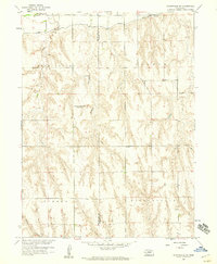
1958 Map of Danbury NE
USGS Topo · Published 1958About this map
The Republican River valley defines the northern edge of this landscape, flanked by the Bartley Canal and the tracks of the Chicago Burlington and Quincy railroad. This 1958 survey captures a rural Nebraska terrain transitioning from the irrigated river bottom to the deeply dissected uplands of Indianola East Valley and the prominent Missouri Ridge. The map reveals a pattern of consolidation or rural shift, indicated by several inactive educational landmarks including Valley Center Sch, School Creek Sch, and School No 60. Beyond the infrastructure of the Missouri River Basin development program, local history is preserved at Trinity Cem and through industrial features like the Gravel Pit and Quarry. Local drainage is managed through systems like Dry Creek and School Creek, which carve through the high plateaus of Tyrone.
Find a feature on this map
16 named features on this map. Tap any name to fly to it.
Don’t see what you’re looking for? This feature index may not catch every label — zoom into the map to look around manually.
Map Details
Editions of this 1958 Danbury NE Map
This is the sole edition of this map. No revisions or reprints were ever made.
Other maps of this area

1954 · McCook
USGS Topo · 1:250,000

1956 · Cambridge
USGS Topo · 1:24,000

1956 · Bartley
USGS Topo · 1:24,000

1957 · McCook
USGS Topo · 1:250,000

1957 · Shippee
USGS Topo · 1:24,000

1957 · Danbury
USGS Topo · 1:24,000

1957 · Lebanon
USGS Topo · 1:24,000

1957 · Danbury NE
USGS Topo · 1:24,000

1958 · McCook
USGS Topo · 1:250,000
1958 · Wilsonville NW
USGS Topo · 1:24,000