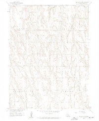
1958 Map of Wilsonville NE
USGS Topo · Published 1959About this map
Horse Canyon and Timmons Creek carve a series of deep drainage patterns across this rural landscape in Furnas County during the late 1950s. The map illustrates the administrative divisions of Logan, Vincent, Wilsonville, and Lynden townships, revealing a grid of unimproved dirt roads and light-duty paths that served the agricultural community. Produced as part of a Department of the Interior program for the development of the Missouri River Basin, this survey provides a precise record of the upland terrain before modern changes. Researchers can trace the section lines and elevation contours that defined property boundaries and land use in this Nebraska panhandle region, where the relief is marked by the sharp contrast between flat divides and the creek valleys.
Find a feature on this map
6 named features on this map. Tap any name to fly to it.
Don’t see what you’re looking for? This feature index may not catch every label — zoom into the map to look around manually.
Map Details
Editions of this 1958 Wilsonville NE Map
2 editions found
Other maps of this area

1896 · Arapahoe
USGS Topo · 1:125,000

1898 · Arapahoe
USGS Topo · 1:125,000

1954 · McCook
USGS Topo · 1:250,000

1955 · Grand Island
USGS Topo · 1:250,000

1956 · Cambridge
USGS Topo · 1:24,000

1957 · McCook
USGS Topo · 1:250,000

1957 · Grand Island
USGS Topo · 1:250,000
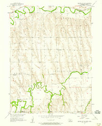
1957 · Beaver City SW
USGS Topo · 1:24,000

1957 · Shippee
USGS Topo · 1:24,000
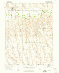
1957 · Wilsonville
USGS Topo · 1:24,000