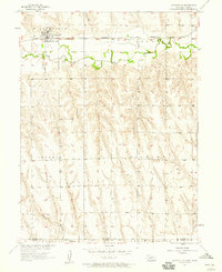
1957 Map of Wilsonville
USGS Topo · Published 1958About this map
Wilsonville serves as the focal point of this late-1950s survey, positioned along the northern bank of Beaver Creek. The village layout is intricately detailed, showing a central grid with a Water Tank and a Cem on its western outskirts, reflecting the development patterns of a Nebraska farm-to-rail hub. The Chicago Burlington and Quincy railroad cuts a straight line through the valley, paralleling the creek and defining the local transport economy.
Find a feature on this map
14 named features on this map. Tap any name to fly to it.
Don’t see what you’re looking for? This feature index may not catch every label — zoom into the map to look around manually.
Map Details
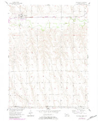
Editions of this 1957 Wilsonville Map
2 editions found
Other maps of this area

1893 · Norton
USGS Topo · 1:125,000

1896 · Arapahoe
USGS Topo · 1:125,000

1898 · Arapahoe
USGS Topo · 1:125,000

1951 · Norton
USGS Topo · 1:62,500

1951 · Norcatur
USGS Topo · 1:62,500

1954 · McCook
USGS Topo · 1:250,000

1954 · Goodland
USGS Topo · 1:250,000

1955 · Grand Island
USGS Topo · 1:250,000

1955 · Beloit
USGS Topo · 1:250,000

1956 · Goodland
USGS Topo · 1:250,000