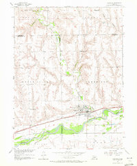
1956 Map of Cambridge
USGS Topo · Published 1972About this map
The confluence of the Republican River and Medicine Creek provides the geographic focus for this 1956 study, where the town of Cambridge serves as a critical junction for the Chicago Burlington and Quincy railroad. The map documents a classic Nebraska agrarian landscape characterized by upland plateaus and deep-cut drainages like Smith Canyon and Silver Creek. The settlement pattern reflects the importance of localized education and community hubs, evidenced by several rural schoolhouses scattered across the townships, including Mousel Sch, Mt Zion Sch, and North Valley Sch.
Find a feature on this map
27 named features on this map. Tap any name to fly to it.
Don’t see what you’re looking for? This feature index may not catch every label — zoom into the map to look around manually.
Map Details
Editions of this 1956 Cambridge Map
3 editions found
Other maps of this area

1954 · McCook
USGS Topo · 1:250,000

1956 · Freedom
USGS Topo · 1:24,000

1956 · Cambridge
USGS Topo · 1:24,000

1956 · Medicine Creek Dam
USGS Topo · 1:24,000

1956 · Bartley
USGS Topo · 1:24,000

1957 · McCook
USGS Topo · 1:250,000

1957 · Danbury NE
USGS Topo · 1:24,000

1958 · McCook
USGS Topo · 1:250,000

1958 · Danbury NE
USGS Topo · 1:24,000
1958 · Wilsonville NW
USGS Topo · 1:24,000