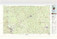
1986 Map of Camden
USGS Topo · Published 1986About this map
The Ouachita River and Saline River valleys dominate this South Arkansas landscape, carving paths through the timberlands of Ouachita, Calhoun, Bradley, and Cleveland Counties. In the mid-1980s, the industrial footprint of the region is centered on the city of Camden, where the expansive Abandoned Ammunition Depot sits as a massive relic of military-industrial history. The map records a dense network of timber-and-transport infrastructure, with the St Louis Southwestern and Missouri Pacific railroads linking historic milling towns like Eagle Mills and Thornton.
Find a feature on this map
58 named features on this map. Tap any name to fly to it.
Don’t see what you’re looking for? This feature index may not catch every label — zoom into the map to look around manually.
Map Details
Editions of this 1986 Camden Map
This is the sole edition of this map. No revisions or reprints were ever made.
Other maps of this area

1901 · Gurdon
USGS Topo · 1:125,000

1903 · Camden
USGS Topo · 1:125,000

1934 · Ingalls
USGS Topo · 1:48,000

1934 · Moro Bay
USGS Topo · 1:62,500

1935 · Feenyville
USGS Topo · 1:62,500

1935 · Noble Lake
USGS Topo · 1:62,500

1937 · Ingalls
USGS Topo · 1:62,500

1938 · Moro Bay
USGS Topo · 1:62,500

1939 · Moro Bay
USGS Topo · 1:62,500

1939 · Ingalls
USGS Topo · 1:62,500