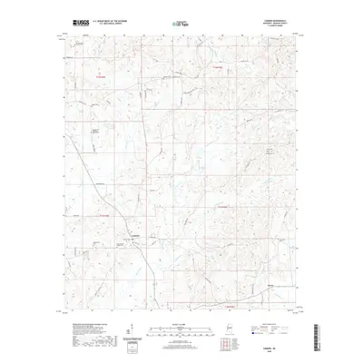
2020 Map of Camden
USGS Topo · Published 2020About this map
Camden serves as the primary hub of this North Mississippi landscape, where the settlement pattern is defined by a network of rural roads and numerous denominational cemeteries. Significant local landmarks include the Old Truelight Church Cem and the Pleasant Hill Missionary Baptist Cem, alongside the Great Murphy Chapel Cem. These sites, often situated near family-named roads like Mullinville Rd and Albert Catchings Rd, suggest a deeply rooted community history tied to the land.
Find a feature on this map
65 named features on this map. Tap any name to fly to it.
Don’t see what you’re looking for? This feature index may not catch every label — zoom into the map to look around manually.
Map Details
Editions of this 2020 Camden Map
This is the sole edition of this map. No revisions or reprints were ever made.
Other maps of this area

1953 · Meridian
USGS Topo · 1:250,000

1957 · Meridian
USGS Topo · 1:250,000

1960 · Sharon
USGS Topo · 1:62,500

1961 · Carthage
USGS Topo · 1:62,500

1962 · Thomastown
USGS Topo · 1:62,500

1964 · Camden
USGS Topo · 1:24,000

1964 · Newport
USGS Topo · 1:24,000
1964 · Goodman
USGS Topo · 1:24,000

1965 · Meridian
USGS Topo · 1:250,000
1966 · Goodman
USGS Topo · 1:62,500